


Seceda

VacheKiri67
Gebruiker
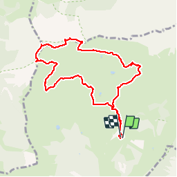

Lengte
9,2 km

Max. hoogte
2509 m

Positief hoogteverschil
465 m
Km-Effort
15,4 km

Min. hoogte
2085 m

Negatief hoogteverschil
468 m
Boucle
Ja
Datum van aanmaak :
2019-08-03 08:41:45.515
Laatste wijziging :
2019-08-03 15:04:25.26
4h53
Moeilijkheid : Medium

Gratisgps-wandelapplicatie
 SityTrail
IGN / Geografische instituten
SityTrail Plus
De wereld gaat voor u open
Over ons
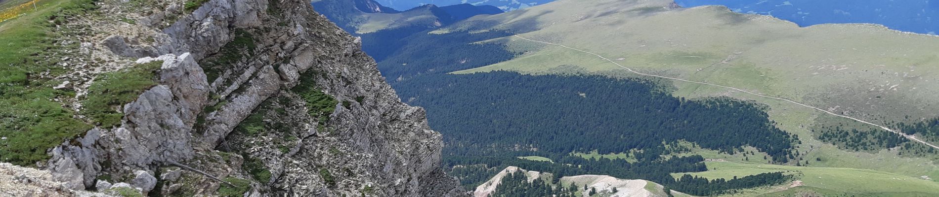
Tocht Stappen van 9,2 km beschikbaar op Trento-Zuid-Tirol, Bolzano - Bozen, Santa Cristina Gherdëina - St. Christina in Gröden - Santa Cristina Valgardena. Deze tocht wordt voorgesteld door VacheKiri67.
Foto's


99 fotos in totaal. Klik op een foto om ze allemaal in de galerij weer te geven.
Plaatsbepaling
Land:
Italy
Regio :
Trento-Zuid-Tirol
Departement/Provincie :
Bolzano - Bozen
Gemeente :
Santa Cristina Gherdëina - St. Christina in Gröden - Santa Cristina Valgardena
Locatie:
Unknown
Vertrek:(Dec)
Vertrek:(UTM)
710348 ; 5162703 (32T) N.
Opmerkingen